Category Archives: Travel

Hello again, dear Chicago | Hoi Chicago! (Alweer)

https://www.youtube.com/watch?v=MpCoidxg6Ek

No blog the past two days, Thursday I was knackered and needed the extra sleep, yesterday was busy with catching up with friends! Geen blogje de afgelopen twee dagen, ik was stikkapot donderdagavond, en kon dat uurtje extra slaap wel gebruiken, gisteren de hele dag vrienden bezocht!

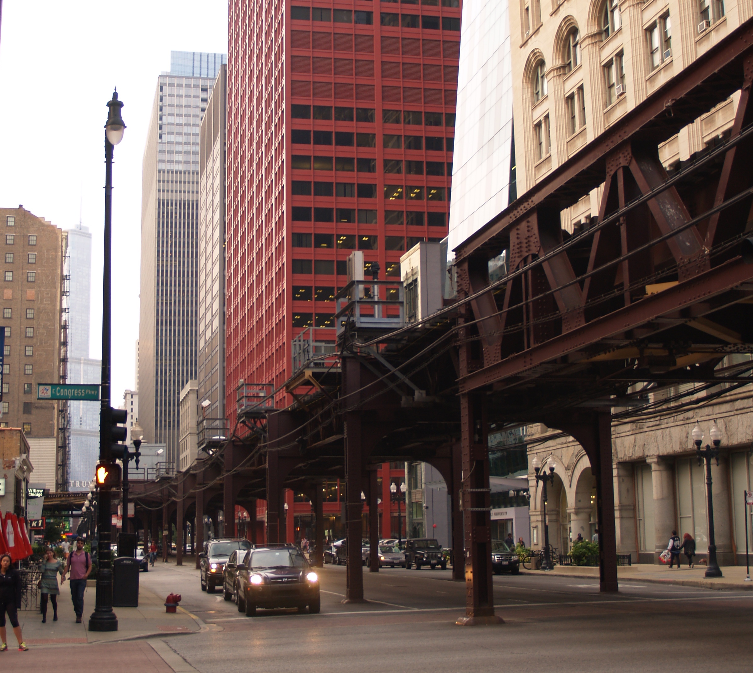
Five months ago I was in Chicago. It was cold, but at least not snowing anymore.  Well, not really snowing, just a flurry of flakes one early morning.  Thursday night conditions were rather more clement, and I sat outside the Emerald Loop an “Oirish” pub. They also had this on tap. Vijf maand geladen was ik voor het eerst in Chicago. Het was nauwelijks lente (=temperaturen weer boven het vriespunt) en we hadden toch nog een paar verdwaalde sneeuwvlokjes. Gisteren was het weer veel aangenamer en dus kon ik een terrasje doen bij de Emerald Loop, een “Ierse” pub waar ook dit te vinden was. 

Compulsory food picture | verplichte foto van het avondmaal:

And as a PSA: this label is incorrect| boodschap van algemeen nut: deze mosterd is niet uitgietbaar, zoals het etiket nochtans beweert:


I had it upside down a good ten minutes and the mustard hadn’t even moved. Just so you know. Ik had de fleS zo’n tien min. op zijn kop gezet en die mosterd bewoog geen millimeter. 

Before getting to the Windy City, there was another day of chewing the miles, along the I-80/90. The landscape was not very compelling, a lot of it reminded me of Flanders, except there was more of it. If you drive three hours in Belgium you’re waaaaay out of the country! Here, you’ve not even made it to the next state.

Voor ik in Chicago was, waren er weer een hoop kilometers te rijden voor ik aan al dat lekkers toe was. Het landschap was niet spectaculair, maar deed me bij momenten wel denken aan Vlaanderen. Met dat verschil dat je in België na drie uur rijden het land uit bent en al lang een ander landschap rond om je hebt. Hier ben je nog niet eens de staat uit!

Pictures from my March visit | Foto’s van mijn bezoek in maart

IMG_1789IMG_1811IMG_1819 IMG_1813

And some from this trip | En enkele van dit bezoek

OLYMPUS DIGITAL CAMERA2015-08-27-22015-08-27-3

Coming up next: Wisconsin! |Volgende aflevering: Wisconsin!

Scenes from SLMM 2014

The Saunders Lakeland Marathon 2014 took place in Deepdale (near Patterdale) in the Lake District, on 12-13 July. Team Kingfisher (=Marj and I) was there, and I wrote up these short scenes to give you some idea of what happened and what goes through my mind while we’re out there. For the basics of Mountain Marathoning UK style, please look here. Click on the pictures for a bigger view, in my Flickr account (doesn’t work for the bits of map).

Getting there

I’m running, with a big backpack. I’m not yet even anywhere near the Lake District where the race will take place. I am running through Brussels, on my way to the railway station to catch the Eurostar. The best laid plans of mice and men… I checked carefully which tram would get me there on time, but unfortunately two trams did not show up at all. Traffic congestion further up the line, I hear later. I see multiple trams going the other way, and I wonder if all these trams ride down some dark hole, never to be seen again… That might explain why none of them ever come back up the line again.

I am running with quite a bit of additional weight, this is everything I need for four days away and not my light race pack with minimal kit. The breathing is fine, it’s comforting to know the training pays off. The knee, however, isn’t fine after about 10 minutes of this unexpected extra training. I slow down to a walk, and curse the Brussels public transport authority under my breath. If this race turns into a DNS (did not start), because I bugger up my knee, they’ll hear about it.

I make it into the Eurostar terminal, and just as I am looking around to find a place to sit down and have a breather, boarding begins. I am glowing profusely (horses sweat, men perspire, ladies glow, apparently) but I caught the train. On the train from London to Cambridge I text my teammate Marj with a request for a bag of frozen peas to ice my knee, just to be on the safe side. I also get a tweet from Brussels transport with an apology for the delay, after I called them out on Twitter. Kind, but as useful as a chocolate ashtray on the back of a motorbike… Team Kingfisher is reunited at basecamp Cambridge before driving out to the Lake District. We’re a bit apprehensive, but excited none the less, when the “lumpy bits” come into view.
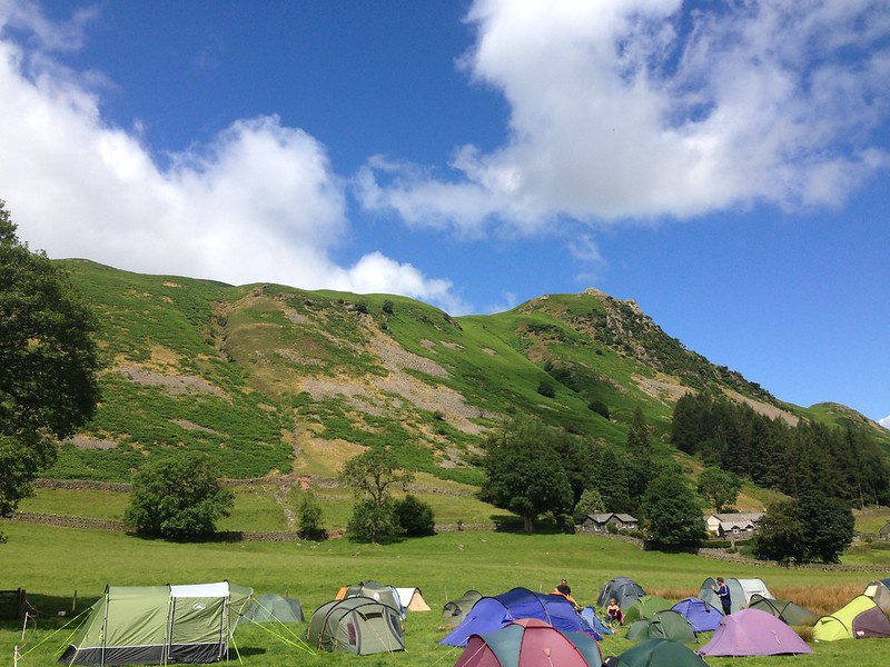
IMG_0994

Base camp at Deepdale, the evening before the race.

Victory no. 1: the start line

If you’re training for a long race, like a marathon or a multiple day event, getting fit to the starting line is a victory in itself. The year has been hard for both of us. Training this winter for me felt more like I was preparing for the winter Olympics, with all the snow and temperatures that made my freezer seem comfy warm, but things improved when spring finally came. Marj had more serious setbacks, which left us hesitating to sign up for the race until March. But now we are at the start line, and we are over the moon. We’re feeling ready, my knee is fine. We know it won’t be easy (though we don’t know yet how bad it might be), but as we line up for our start, we lift our eyes unto the hills and feel the thrill of the race. Bring it on!


Ups and downs


wall of stone-map view

We’re sliding down a hill side, and dropping height quickly. This is good, because I managed to waste time and energy by going past the 1st control, and we had to turn back. In my defence, it was located east of the boulder, and not west as indicated on the directions. We saw many other teams struggling to find the darn thing but I should do better as chief navigator and keep my eyes peeled. The 2nd control took us up a steep hillside, but was easy enough to find. But it came with the realisation that we have to get over this sheer wall of stone in front of us, and then immediately back down again to number 3, and there is no path down… Fortunately, there is soft grass, and so we just slide down and lose about 250 meters in no time.
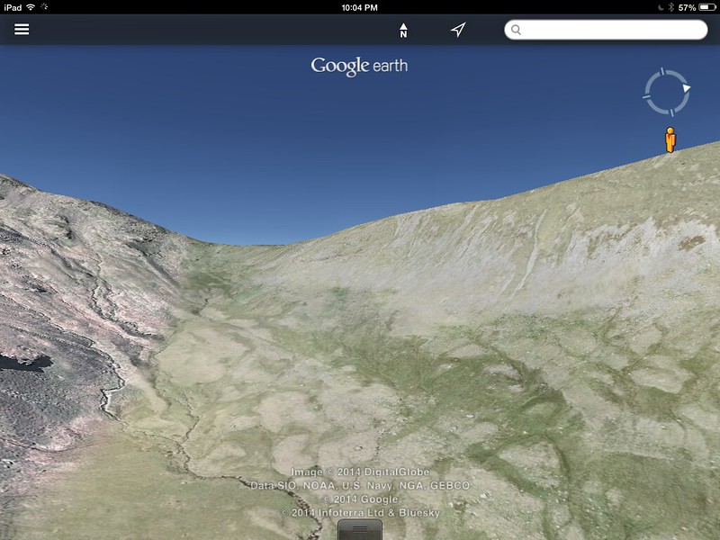
IMG_0032Google Earth view of the wall of stone, we have to get to the other side…
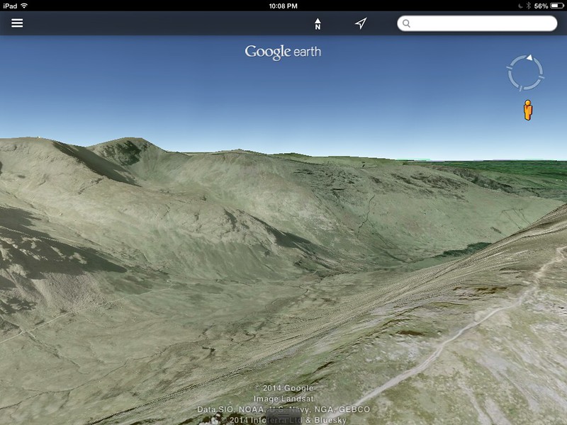
IMG_0034Google Earth view of the descent from the top of the wall of stone to control 3. This looks more reasonable than in real life…

We then have a long way to go to control 4 (Look! Picture!), but there is a path and the views are rewarding: Ullswater in the distance, as we are going around Grisedale Brow. I can’t quite see the way to control 5 yet, but the contour lines on the map are ominously close together. There is a path, but with many switchbacks (i.e. zigzags), which suggests the same: it’s going to be seriously uphill, baby.
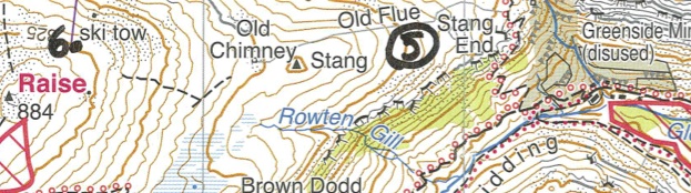
switchback and ski tow-map view

The list of should-haves

With every race, there is a list of should-haves. A sample of my past races: I should have trained harder/differently; I should have put on different socks; I should not have had that fish and chips yesterday for dinner. Today’s should-haves include: I should have checked the map and seen that we need to take on water at Mires Beck, where everybody else was doing this. As it is, we’re working our way up the steep path to control 5, and there is no good source of water until we’re heading off the mountain towards the end of the day. I am fine, but Marj is starting to have trouble as we make our way to the top of the ski-tow where control 6 awaits us. The climb is a good 225m higher up from control 5, although not vertical, but the long day is getting to her. There’s another one: I should have made sure my teammate is “grazing” on snacks throughout the day, like me, but it’s hard to force food into somebody who claims not to be hungry. But hauling yourself and a pack up the hills consumes a crazy amount of calories and they need to be replenished, even if your health situation means appetite is suppressed when you’re nearing exhaustion. We have a brief rest, ration the water, and prepare for the big one: the top of Helvellyn, the third highest peak in England at 950m. We will just follow the path south to Whiteside (868m), then onto Helvellyn Lower Man (925) and Helvellyn itself a bit further with control 7. We have to go this way to get off the hills anyway, to the midway camp, and we’re not giving up. Not yet.

Stairway to Heaven

I am walking on the saddle between White Side and Lower Man. To my left in the distance the blue Ullswater. On my right I see Thirlmere, another lake. I have done this route on Google Maps as part of my orientation preparation, but that pales in comparison with the real thing. At the far end, where the path climbs to Lower Man, the sheer cliff face from Swirral Edge bumps into the top of Browncove Crag. I am walking on the spine of the world, and I am suddenly overcome by intense emotion: utter bliss, feeling part of the universe, and a deep sense of gratitude that I am allowed to be here. I am exhausted, thirsty, hungry and could lie down for a nap here and now, yet I feel more alive, in every cell of my body, than ever before. This moment of pure joy is worth every step of the long and hard way we took to get here. I am on the stairway to Heaven.

Google Earth view of my stairway to Heaven. It doesn’t do it justice at all. Go up there and experience it for yourself. Worth every step of the way. Go on. You know you want to.

Who moved my sheepfold?

I am walking back up the hillside in search of a blimmin’ sheepfold that contains control 8. I saw it as we were walking down from Helvellyn and started our descent on the path to the north of Birk Side. It’s freaking big, you can’t just tuck it away. Yet that is exactly what happened, because as we were going down the path it did not just pop up on our left side as it should have.

Now we have come down too far. Marj is completely exhausted, but we found water. While we wait for the purification tablet to work its wonders, I decide to trot back up and find the control. I look back regularly to make sure I know where to find her again. You’re not supposed to leave your teammate, but asking her to go back up there is just mean at this point. There is no danger of hill fog, so we should be fine. I am annoyed with myself for missing a second control in one day. Chief-navigator and Master of the Map, my a***. The sheepfold is as big as a house, literally- how can you miss it? Some kind competitors confirm my suspicion that it is just a bit further to the north, and my determination (stubornness?) pays off. I stick the dibber into the control and I have rarely been this relieved to hear the *beep beep* as it radioes our time to race HQ.

I go back down to pick up Marj, who’s significantly more chipper now we have water, a rest, and some food. We study the map, and head out in search of control 9, which is all the way at the bottom of the hill, some 350m lower.

sheepfold to finish-map view

Lessons learned from last year

I don’t like the look of those contour lines. One of the should-haves from last year pops into my head, and I remind Marj of the longest twenty minutes of our lives. I can’t quite see how we- completely at the end of our reserves by now- will make it safely down between the cordonned-off area and the stream, on a hillside at a 45º angle or worse. We’re not even worrying anymore about being done before the cut-off time, that is pie in the sky by now.

“You see those runners there? That’s where I’d like to be.” I say to Marj. She’s good at finding paths and making tracks, and is usually out in front doing exactly that. Much to my relief, she complies with my request, even if it means going back up 100m or more, so we can safely cross the stream. I see my old friend the sheepfold again, from a distance. It feels like we’re going round in circles this last hour, but at last we get on the other side of the stream, and onto the grassy hillside. This one is also at a silly steep angle, but there is space. And we can slide down, because there is simply no point in standing up. As soon as we take two steps, we’re back on our bum, so we lose a good 300m height in very good time. We are both very happy with the decision to take this route, even if it looked like a detour. No gorse or bracken to pick out of our underwear (and worse places) for the next three days, like last year.

To the finish, and victory again!

We get to control 9, and our quick descent means we do actually stand a chance of making it to the final control on time. It is just a few hundred meters along an easy, even path. We clock off with ten minutes or so to spare. The course was much harder than last year- with 18km and 1310m of height in the ideal case, and my navigation mistakes added probably another 2-3km and maybe 150m. We’ll worry about tomorrow after we have had some food and a rest. Today is a major victory, and we’ll cherish it.

Amai! Wie had dat gedacht? | My word! Who would have thought?

Vorige maand is een stukje muziekgeschiedenis geschreven in het dorpje Gijzegem waar ik het eerste stuk van mijn leven sleet. Het volledig gerestaureerde van Peteghem orgel in de St.- Martinuskerk werd officieel ingespeeld!
Dat orgel dat daar jarenlang hoog boven de ingang van de kerk hing, dat is blijkbaar een belangrijk stukje erfgoed. Er bestaan nog wel orgels van deze orgelbouwende familie, maar het mooie aan het exemplaar in Gijzegem is dat het grotendeels is gevrijwaard van verbouwingen en “verbeteringen”. Het is nu volledig hersteld in de oorspronkelijke staat van 1774-76 en mag gerust gezien en gehoord worden. Ik had tijdens mijn kinderjaren wel vaag iets gehoord over hoe geweldig dat orgel ooit geweest was, maar het was al lang onbespeelbaar. Nu weerklinken de mooiste tonen weer uit de pijpen.

A small piece of music history was written last month in the village Gijzegem where I spent the first part of my life. The first official concert was played on the van Peteghem organ in the village’s St Martin’s church, after a successful restoration.
So it turns out that that organ hanging over the entrance of the church all those years is a very important bit of cultural heritage. This is not the only van Peteghem organ in existence, but this particular one has largely escaped the tendency of our forefathers to “improve” and “rebuild”, and it is now restored to its original state of 1774-46, and it is equally pleasing to eye and ear. During my childhood I had been told that it once had been a very nice instrument, but for donkeys years it was no longer in use. Now, however, the pipes produce the most beautiful tones once again.

Excuses voor de kwaliteit- iPhone foto’s zonder bewerking!
Apologies for the quality- iPhone pics without any further processing!20140709-212217-76937662.jpg


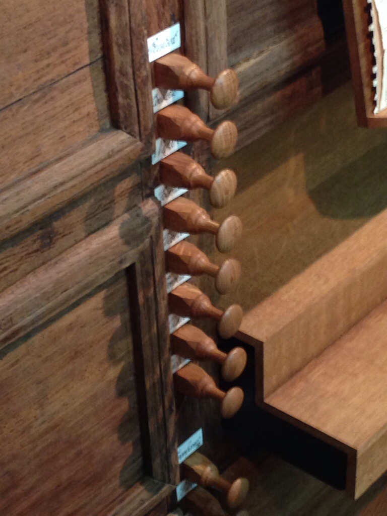
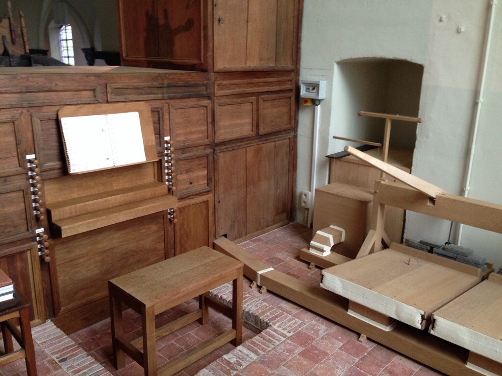
Volgende drie foto’s: stoppen, orgelpijpen in de kast, en het klavier. Next three pictures: stops, pipes in the “cupboard”, and the keyboard

20140709-212509-77109566.jpg

20140709-212508-77108862.jpg

20140709-212508-77108083.jpg

De originele terracotta vloer van het doksaal is terug te bewonderen. N.B. geen pedalen bij dit orgelklavier. Dat blijkt helemaal geen probleem te zijn om toch mooie muziek te maken.

The original terracotta tiles on the rood screen (choir screen) are on display again. Note: no pedals to go with this organ keyboard. It still makes marvellous music.

20140709-212829-77309357.jpg

Wil je het orgel horen? Dat kan. Dit historisch orgel wil bespeeld worden, en de organisten onder ons kunnen er zelf op komen spelen- ik breng jullie graag in contact met de vereniging Vrienden van het Orgel van Gijzegem. Voor de anderen is het volledige programma van het eerste concert op 1 juni 2014 op CD opgenomen. Bestellen kan je hier. Het boekje bevat uitgebreid uitleg over het orgel, de restauratie, en de stukjes muziek, de kwaliteit van de CD is technisch heel verzorgd, en de muziek is… hemels. Ik stond ervan versteld toen ik de CD voor de eerste keer hoorde. “Dat is opgenomen hier in Gijzegem?!?” Amai. Wie had dat gedacht? Cultuur en geschiedenis van de bovenste plank hier vlak om de hoek bij mijn ouders.

If you want to hear the organ, you’re in luck! This historical organ wants to be played, and the organ players among us can have a go- I’d be more than happy to get you in touch with the Friends of the Organ in Gijzegem. For the less talented, the entire playlist of the first concert on 1 June 2014 has been recorded on CD and you can order via this site. (If the Dutch language troubles you, I am more than happy to be a go-between. The booklet does, however, provide a full English language translation with details of the music and the organ restoration.) The technical quality of the CD is extremely high, and the music is… to die for. When I first heard the CD I was dumbstruck. “That has been recorded on the organ in Gijzegem?!?” My word, who’d have thought! Top-notch culture and history right around the corner from my parents’!

De St Martinuskerk zelf is ook een bezoekje waard. Ze maakt deel uit van Open Kerken, en je kan ze bezoeken: van 1 juni tot 30 september: vrijdag – zaterdag – zondag : 13.30 – 18.00. Meer info op de Open Kerken website.

St Martin’s Gijzegem is also worth a visit. The church is part of the Open Churches project, and you can visit! 01/06 – 30/09 : Friday – Saturday – Sunday : 1.30 pm – 6.00 pm
More info on the Open Churches website.

Welke stukjes geschiedenis zitten er bij jullie om de hoek? Laat me weten via de reacties en misschien kom ik langs! Do you have any pieces of history hidden around the corner? Let me know in the comments, and I’ll try to drop by!

20140709-220855-79735308.jpg


Dunhua! 敦化 (not to be confused with Dunhuang 敦煌)

Jingbo Lake and the surrounding sights were fun, even with (or perhaps exactly because of) the Chinese tourgroup I joined. But the pictures will speak louder than words, and I can’t give you those quite yet. Patience is a virtue, more when I am back sometime next week.

Het Jingbo Meer en de nabije zichten waren heel leuk, zelfs met (of misschien net vanwege) de Chinese reisgroep waar ik me bij aansloot. Maar foto’s zeggen zoveel meer dan woorden, en dus moeten jullie even geduld uitoefenen. ‘t Is een schone deugd, en volgende week ofzo volgt er meer.
OLYMPUS DIGITAL CAMERA
Dunhua is the heart of the oldest bits of Bohai history. Unlike the main capital from the later period, Shangjingcheng just north of Jingbo Lake, they haven’t quite got the idea of heritage tourism yet here. The main attraction is a temple from the Qing dynasty (1644-1912) with a massive bronze Buddha statue atop the nearby mountain, and an entrance ticket to the temple complex to match (by Chinese standards). It seems to have received a big infusion of money in 1992, and doesn’t look very authentic.

Dunhua is het hart van de oudste stukjes Bohai geschiedenis. Maar in tegenstelling tot de site van de latere hoofdstad Shangjingcheng net ten noorden van het Jingbo Meer, hebben ze hier nog niet begrepen hoe het zit met erfgoed toerisme. De voornaamste attractie is een tempel van de Qing dynastie (1644-1912), met een enorme bronzen Buddha bovenop een heuvel, en een toegangsticket met gelijkaardig enorme prijs (naar Chinese normen) voor het tempelcomplex. Ik meen te begrijpen dat het in 1992 ofzo een flinke financiële infusie kreeg en het ziet er niet authentiek uit.

Instead, I got a taxi driver and a map, and asked him if he could take me on a little expedition to Chengshanzi, a small village where a mountain fortress has been found. We managed to find that one: there is a stone to mark it, though the hill is completely overgrown and not accessible. I don’t want to get in trouble with the police or locals with illegal entry, and was happy to just take in the surroundings of this historical spot. A second site, the Yongsheng remains on the opposite bank of the Mudanjiang, however, has not been marked or the locals don’t know where it is, because they swore high and low there there were “no ancient things around here!” The third site south of Dunhua was the royal cemetery, which is marked clearly, and taken care off. Unfortunately not today- or not open for visitors. I declined the invitation to crawl under the fence as some people seemed to have done before me. Crimes against archaeology and cultural heritage can be severely punished, and it is best not to give the wrong impression. Too bad, but again: getting some idea of the lay of the land makes reading the excavation reports so much easier.
OLYMPUS DIGITAL CAMERA
Geen tempel dus, maar ik nam een taxi en de kaart, en vroeg de chaufeur om mee te gaan op expiditie naar Chengshanzi, een klein dorpje waar een heuvelfort werd gevonden. Dat hebben we zelf ook gevonden: er is een gedenksteen die de plaats markeert. Hogerop was de heuvel helemaal overgroeid. Ik ben hier als toerist en heb dus geen officiële toelatingen om archaeologie te doen, dus was ik al lang blij dat ik even op deze historische plek kon staan. Een tweede site, de Yongsheng ruine aan de andere kant van de Mudang rivier, is echter niet gemarkeerd, en de plaatselijke bevolking wist ook van niets “Niks oud hier in de buurt!” Een derde site ten zuiden van Dunhua, het koninklijk kerkhof, is wel aangeduid en verzorgd. Maar helaas niet vandaag: niet open, geen bezoekers. Ik besloot wijselijk niet in te gaan op de uitnodiging om onder het kippegaas te kruipen, zoals een paar mensen me blijkbaar hadden voorgedaan. Je wil niet de verkeerde indruk geven in een land waar archaeologie en cultureel erfgoed met heel strenge wetten beschermd worden. Jammer, maar opnieuw: goed om een idee te krijgen van de omgeving, dan is het makkelijker om opgravingsrapporten te lezen.

More about what I found in the afternoon later. WordPress app is slowing down… I will in due course update with pictures.
Meer over wat ik in de namiddag nog vond; de WordPress app op mijn iPad begint vast te lopen… Foto’s volgen nog, zodra ik kan.

(updated 14 September 2014: added pictures/ Bijgewerkt 14 september 2014, foto’s toegevoegd)

Wat klopt er niet? -Something is wrong…

Rugzak voor China: de nieuwe rugzak is 10L kleiner dan vorige keer; maar nu er alles in zit heb ik nog plaats over. Wat ontbreekt er in mijn rugzak? Suggesties in de Comments graag!
Backpack for China: the new pack is 10L smaller than the previous one. Yet with everything packed up I still have space left. What’s missing? Ideas in the comments, please!

And here are some pictures of a site we will visit! (Click on picture to see original size) Hier een paar foto’s van een geplande uitstap. (Klik op de foto voor de originele grootte)

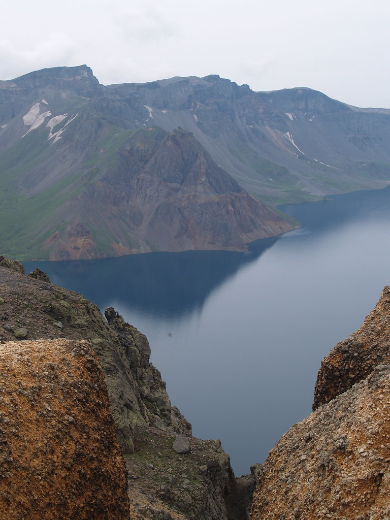
Deep Green Pond, Changbaishan (Jilin province) Diepgroene Vijver, Changbaishan (Jilin Province)

P1016223


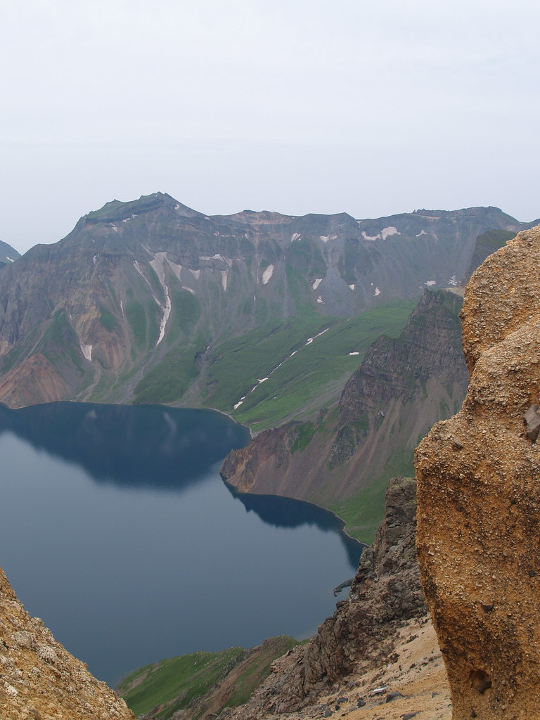
Crater lake of Changbaishan, “Heavenly Lake” (Kim Ilsung was born around here. Hmhm) Kratermeer van Changbaishan, “Hemelse Meer” (Geboorteplaats van Kim Ilsung. Ja hoor…)
P1016086
P1016076

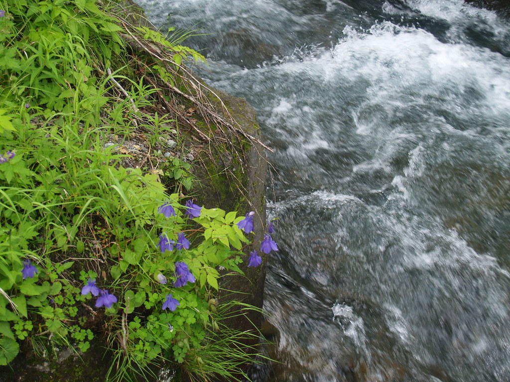
A rare sight in China these days: clear water, clean air, wildflowers. Changbaishan still has it. Een zeldzaam zicht in China dezer dagen: zuiver water, schone lucht, wilde bloemen. Op Changbaishan vind je het nog wel.

P1016253